 Nguyen Manh Thang
Chief Executive Officer, AgileTech Vietnam
Nguyen Manh Thang
Chief Executive Officer, AgileTech Vietnam
- Published
- Read time
- 10 min

Read the AI overview
A GPS tracking system is four layers: a position source (dedicated tracker hardware or phone GPS), an ingestion backend that receives, validates and stores the point stream, a processing layer that turns points into trips, stops, geofence events and alerts, and the surfaces where humans watch, a live map, histories and notifications. The first decision is the position source: dedicated devices cost 20 to 150 dollars plus SIM data but track the asset itself reliably; phone GPS is free hardware but tracks a phone and a battery and a person's app settings. A focused tracking MVP, one use case, device ingestion, live map, geofences and alerts, runs 40,000 to 90,000 dollars at offshore rates over three to five months. Fleets needing dispatch, maintenance and fuel should evaluate full fleet platforms instead; pure tracking is the right build when tracking is the product or the platform layer is already owned.
GPS tracking is the rare software category where the demo and the product are separated mostly by things you cannot see in the demo: what happens when the device sends points out of order, what the map shows when a tracker sleeps in a steel container, whether the geofence alert that fired at 3 a.m. was an arrival or a GPS wobble, and who is allowed to see whose location under what law. The moving dot is a solved problem; the system around the dot is the build.
This guide covers that build end to end: the three distinct tracking products hiding under one name, the device-versus-phone decision that shapes everything downstream, the ingestion backend and its unglamorous realities, the processing that turns points into trips and events, the geofence and alert layer where operational value lives, the accuracy truths that should shape the design, and the phased plan with honest budget ranges.
It has close neighbors in this cluster: the telematics pipeline guide goes deeper on the data engineering between tracker and dispatcher, the fleet platform build guide covers the full operations system a tracking layer often grows into, and the sensor guide covers the hardware beyond position.
Key takeaways
- Name the product first: vehicle tracking, asset tracking and personal tracking share a map and differ in everything else, hardware, power budgets, privacy law.
- The device decision is the architecture decision: dedicated trackers follow the asset, phone GPS follows a person's phone, battery and app settings.
- The backend is an ingestion pipeline, not a CRUD app: device protocols, out-of-order points, deduplication and trip assembly are the actual work.
- Geofences and alerts are where tracking becomes operational value, and alert tuning discipline decides whether anyone still reads them in month three.
- GPS accuracy is 3 to 10 meters open sky and far worse in urban canyons and indoors; design the product around the error, not the datasheet.
- A focused tracking MVP runs 40,000 to 90,000 dollars offshore in three to five months; fleets needing dispatch and maintenance should compare full platforms first.
Three products share the map
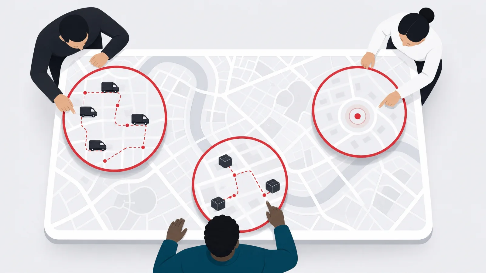
Vehicle tracking is the commercial mainstream: trackers wired into cars, trucks, motorbikes and machinery, powered by the vehicle, reporting position plus ignition and often engine data. Its buyers are fleet operators and its value is operational, utilization, route compliance, theft recovery, driver accountability, which means the tracking layer rarely stays pure: within a year the roadmap wants dispatch, maintenance and fuel, the territory of the full platform build. The honest scoping question for a vehicle product is whether tracking is the product or the first module.
Asset tracking follows things that do not have engines: containers, trailers, pallets, generators, tools, cargo. The defining constraint is power: no vehicle battery means the tracker lives on its own cells for months or years, which drives the entire design toward sparse reporting, a position every few hours, motion-triggered wake-ups, low-power network technologies, and it changes the product from a moving dot to a chain of custody: where has this thing been, when did it move, did it leave the depot. Hardware selection dominates asset tracking economics, and the software must embrace sparseness rather than fake liveness.
Personal tracking covers workforces, lone workers, children, elders and patients, and it is the product where law and ethics lead the design. Consent, purpose limitation, retention limits and the right to switch off are not compliance garnish; they are features, and jurisdictions differ sharply on what employee and family tracking may do. Technically it usually runs on phones, which brings the phone-GPS realities covered below, and its alert layer is safety-shaped: SOS buttons, no-movement detection, arrival confirmations. Consumer-style location products with social features are a different animal, covered in the geolocation app guide.
The three products diverge in hardware, power, reporting cadence and law, and converge in the backend: all three need ingestion, storage, trip and event processing, geofences, alerts and a map. That convergence is why this guide builds the backend once and parameterizes the differences, and it is also the commercial temptation to resist: a system designed for all three at once inherits the strictest constraint of each, battery discipline from assets, privacy machinery from people, protocol sprawl from vehicles, and ships later than a system that picked one and shipped.
The three tracking products
| Product | Position source | Reporting cadence | The defining constraint |
|---|---|---|---|
| Vehicle tracking | Wired tracker, vehicle powered | Seconds to a minute, moving | Grows toward a fleet platform |
| Asset tracking | Battery tracker, months per charge | Hours, or on motion events | Power budget rules everything |
| Personal tracking | Phone GPS, sometimes wearables | Adaptive, battery mediated | Consent and privacy law lead |
One map, three different systems. The power source and the legal regime are the forks that matter.
The device decision: dedicated tracker or phone GPS

Dedicated trackers are the professional default for vehicles and assets because they track the thing itself: wired to vehicle power or running on their own battery, reporting on their own SIM, indifferent to whether any human remembered to charge a phone or grant a permission. The costs are explicit: 20 to 60 dollars for commodity vehicle trackers, 80 to 150 dollars for ruggedized or long-battery asset units, a SIM and data plan per device (one to five dollars monthly on IoT data plans), and the operational machinery of provisioning, installation and firmware management. What you buy with that money is evidentiary quality: the position stream belongs to the asset, continuously, on hardware you control.
Phone GPS is free hardware that is already in everyone's pocket, and for personal tracking and driver-app products it is the only sensible answer. Its limits are structural, not fixable: the phone tracks the person, not the vehicle (the driver walks away with the dot), the OS throttles background location aggressively to save battery, users can disable permissions or the app, and continuous high-accuracy tracking drains phones fast enough to create its own compliance problem. Products built on phone GPS must be designed around cooperation: the user benefits from being tracked (navigation, task flow, safety), or the tracking degrades to whenever-the-app-is-open.
The hybrid pattern is common and correct in delivery and field-service products: phone GPS through the driver app during active work, when the app is foregrounded and the incentive is aligned, plus dedicated trackers on the vehicles that need always-on truth, with the backend reconciling the two streams under explicit precedence rules (hardware wins when both report; phone fills gaps). The reconciliation is real work worth designing early, because two position sources for one vehicle disagree constantly in small ways, and a map that jitters between them looks broken even when both are right.
For asset tracking, the device decision extends into network technology, and battery life is the currency. Standard 4G trackers reporting frequently live weeks; the same hardware duty-cycled to hourly reports lives months; low-power network variants (LTE-M, NB-IoT) stretch further where coverage exists; and BLE tags flip the model entirely, the tag is dumb and cheap, and phones or fixed gateways do the reporting, which works brilliantly inside instrumented sites and not at all outside them. The selection method is unglamorous: define the reporting cadence the use case truly needs, then buy the cheapest device that delivers it for the required lifetime in your actual coverage geography, and pilot it on your actual routes before committing volume.
Choosing the position source
What are you actually tracking, and who cooperates?
-
Vehicles, operational or evidentiary need
Wired dedicated trackers
Vehicle-powered, always on, the stream belongs to the asset, not a phone.
-
Unpowered assets, long deployments
Battery trackers, sparse cadence
Power budget rules; duty-cycled reporting and motion wake-ups stretch months.
-
People, or drivers inside a task flow
Phone GPS, cooperation designed in
The user must benefit from being tracked or the OS and the human switch it off.
-
Vehicles with driver apps, both needs
Hybrid with precedence rules
Hardware truth plus phone context, reconciled explicitly so the map does not jitter.
The ingestion backend: where tracking systems are actually won
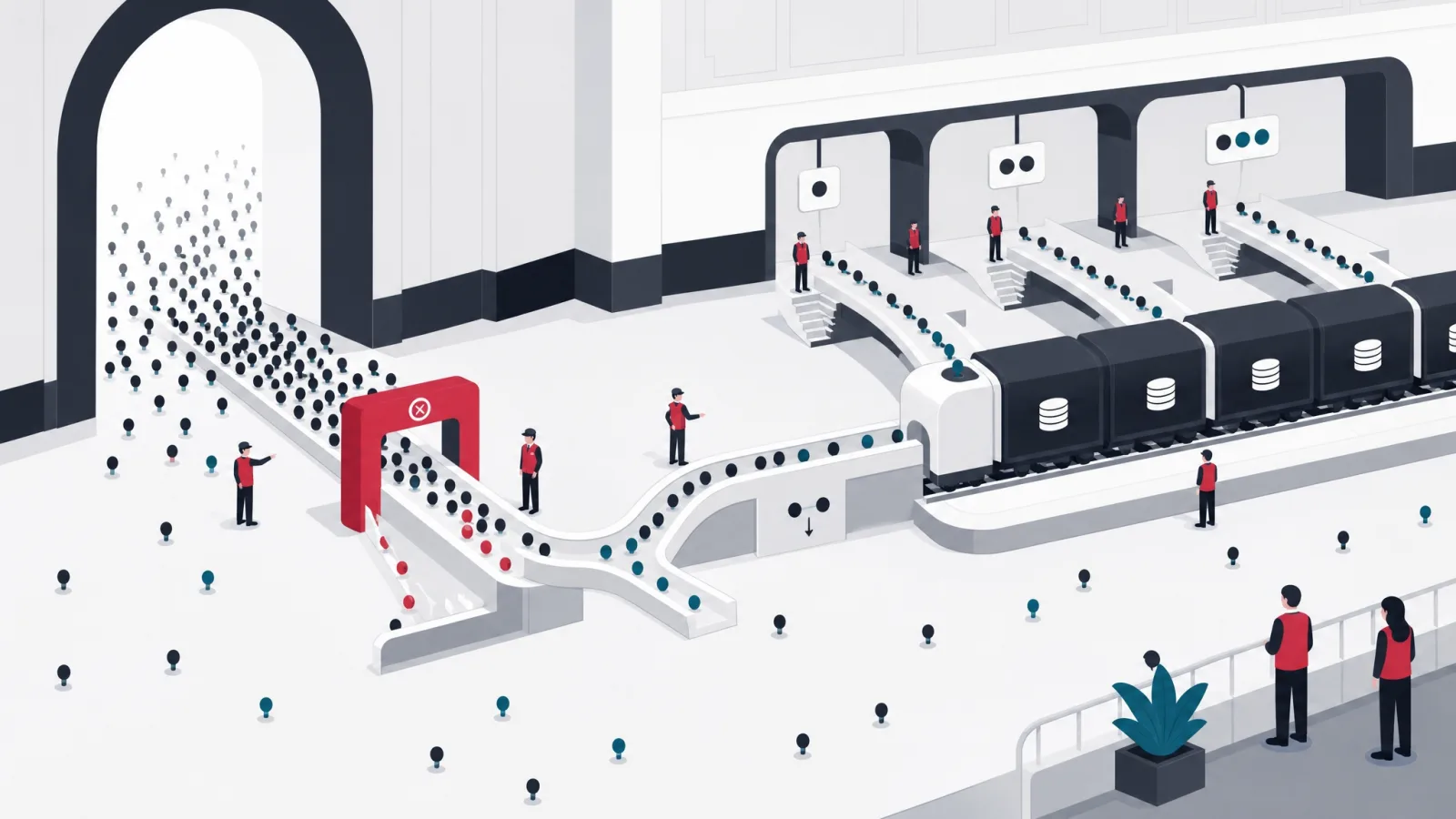
Tracker hardware speaks dozens of protocols, mostly compact binary formats over raw TCP or UDP, occasionally MQTT or HTTP on newer devices, and the first backend component is the protocol gateway that terminates those connections, decodes each vendor's format, and normalizes everything into one internal position message: device, timestamp, coordinates, speed, heading, plus whatever extras the device sends (ignition, battery, inputs). Supporting a device model means implementing its dialect, which is why disciplined products certify a short list of trackers rather than promising universal compatibility, and why the open-source gateway ecosystems are popular starting points that still leave the operational work of device management on your plate.
The stream that arrives is dirtier than any demo suggests. Devices buffer offline and flush hours of history in one burst (out-of-order arrival is normal, not exceptional); they resend points after network hiccups (deduplication is mandatory); they emit GPS noise, positions jumping hundreds of meters while parked, impossible speeds between consecutive points, and the pipeline needs validation and filtering before storage: timestamp sanity, speed plausibility, accuracy-radius thresholds. This layer is covered in full depth in the telematics pipeline guide; the summary for a build plan is that ingestion correctness is roughly a third of backend effort and nearly invisible in demos.
Storage follows the two-shape rule: a live-state store holding each device's latest validated position for the map and the API (small, hot, updated constantly), and an append-only history store holding every point for trails, reports and disputes (large, cold, partitioned by time). The history math deserves a sober minute: a thousand vehicles at ten-second reporting produce north of eight million points a day, which is entirely manageable with time-partitioned storage and entirely unmanageable as naive rows in the application database. Retention policy is a product decision with legal texture, evidentiary use cases want years, privacy law wants minimization, and it should be decided at design time, not discovered at disk-full time.
The real-time path runs beside storage: validated positions publish to a stream, and the live map, alert evaluation and any downstream consumers subscribe. This is also where the API surface is defined for the rest of the product and for customers: current positions, historical trails by time range, trips and events, webhooks for alerts. Products that sell tracking to other businesses live and die on this API, and the design discipline is to build your own surfaces on the same API you sell, which keeps it honest, complete and paginated properly the first time.
The normalized position message
Identity and time
- Identity
- Device id, mapped to asset or person via an assignment table with validity periods, never hardcoded.
- Time
- Event timestamp from the device, arrival timestamp from the gateway, both stored, never conflated.
Payload and quality
- Position
- Coordinates, speed, heading, altitude if present, plus the accuracy estimate when the device reports one.
- State extras
- Ignition, battery level, external inputs, odometer, whatever the protocol carries, stored as typed attributes.
- Quality flags
- Validation verdicts: deduplicated, speed-plausible, accuracy-accepted, so downstream logic can filter by confidence.
Trips, geofences and alerts: where points become value

Raw points are not a product; trips are. Trip assembly segments the stream into journeys and stops using ignition where available and motion heuristics where not, with debouncing so a two-minute traffic light does not end a trip and a thirty-second GPS wobble does not start one. Trips carry the derived numbers everything else consumes, distance (map-matched where accuracy matters, because raw point-to-point distance overestimates on noisy data), duration, stop locations and dwell times, and they are what histories, reports, and any billing or reimbursement logic read. Getting trip logic right for your movement patterns, urban motorbikes segment differently from long-haul trucks, is a tuning exercise the pilot phase exists for.
Geofences turn geography into events: named polygons and radii, depots, customer sites, service areas, restricted zones, with enter and exit events generated as positions cross boundaries. The engineering is straightforward spatial indexing; the product subtlety is state and hysteresis: a vehicle parked on a boundary with ten meters of GPS noise will enter and exit forty times an hour unless transitions require sustained presence (two or three consecutive points inside, or a dwell threshold). Geofence events feed the operational features that justify the system, arrival notifications, unauthorized-movement alarms, zone-based utilization reports, and site-visit verification for field teams.
Alerts are the layer users actually feel, and alert quality is a tuning discipline, not a feature checkbox. The catalog is standard, geofence transitions, movement outside permitted hours, speeding against limits or thresholds, device offline beyond a grace period, low battery, SOS for personal products, but the difference between a system operations trusts and one they mute lives in the details: per-recipient routing (the night-movement alarm goes to security, not everyone), severity tiers with different channels (push for information, SMS or call for critical), grace periods tuned to real network behavior, and escalation when critical alerts go unacknowledged. The decay pattern to design against is alert fatigue; every alert type should earn its noise with an action someone takes.
The surfaces on top are the visible ten percent: the live map with clustering past a few hundred markers, per-asset detail with trail playback, the geofence editor (drawing tools operations staff can actually use), alert configuration, and the reports that answer the recurring questions, utilization, kilometers, site visits, offline devices, exportable because someone will always want the spreadsheet. Mobile surfaces follow the product: a viewer app for managers, an SOS-and-status app for personal tracking, or none at all when the buyer is an operations room with three monitors.
Alert tuning that survives month three
- Every alert has a named recipient and an expected actionAlerts nobody acts on are noise being stored; delete or demote them.
- Hysteresis on every geofenceSustained-presence rules stop boundary jitter from becoming notification spam.
- Severity maps to channelPush for routine, SMS or call for critical, digest for informational; one channel for everything trains muting.
- Offline grace periods match realityDevices drop for minutes routinely; alarm on the anomaly, not the mundane.
- A weekly alert review in the pilotCount fired versus acted-on per type; tune or kill anything below a sane ratio.
The accuracy realities to design around

GPS under open sky delivers 3 to 10 meter accuracy, and every other condition degrades it: urban canyons reflect signals into multipath errors of 20 to 50 meters, tree cover and tunnels cause dropouts, indoors it mostly does not work at all, and cheap tracker antennas widen every band. Modern devices mitigate with multi-constellation reception (GPS plus GLONASS, Galileo, BeiDou) and phones add WiFi and cell positioning that keeps indoor estimates coarse but present. The design consequence is that accuracy is a distribution, not a number, and every feature that consumes position should be built against the distribution's bad tail, not its median.
The product implications are concrete. Geofences smaller than about 50 meters generate false transitions in urban deployments, size them generously and use dwell rules where precision matters. Point-to-point distance sums overestimate real distance on noisy data, sometimes by 10 to 20 percent, which matters the moment kilometers feed billing or reimbursement; map-matching against the road network is the fix. Speed from GPS is noisy at low speeds, so speeding logic should use device-reported speed where available and sanity-filter the rest. And parked vehicles wander: a stationary asset drawing a 100-meter scribble overnight is normal GPS behavior that the map layer should suppress with a parked-state snap rather than alarm on.
Reporting cadence is the second accuracy dimension: a trail is only as good as its sampling. Ten-second reporting draws faithful urban routes; two-minute reporting cuts corners literally, making distance and route-compliance judgments unreliable; asset trackers at hourly cadence produce waypoints, not trails, and the product should present them as such. Cadence also drives the cost triangle, data plan volume, battery life, backend storage, and the honest method is to set cadence per use case from the decision the data feeds: route compliance needs seconds, arrival detection needs a minute, chain of custody needs the transition events more than the points between.
Finally, the adversarial cases deserve a line in every design review. GPS jammers, illegal, cheap, and present in cargo-theft markets, read as sudden signal loss on a moving asset, which is detectable as a pattern and worth an alert of its own. Trackers get unplugged (power-loss alerts exist for the reason), devices get moved between vehicles without paperwork (the assignment table with validity periods is the audit defense), and phone-based tracking gets defeated by airplane mode (design the incentive, not just the surveillance). None of these are exotic; a tracking product that has not thought about them is a demo with a pricing page.
Accuracy vocabulary the team will need
- Multipath error
- Position error from satellite signals reflecting off buildings; the urban-canyon effect behind 20 to 50 meter jumps.
- Multi-constellation
- Receiving GPS, GLONASS, Galileo and BeiDou together; more satellites, better urban fixes, standard on decent modern devices.
- Map matching
- Snapping raw positions to the road network; the fix for inflated distances and off-road trails on noisy data.
- Dwell rule
- Requiring sustained presence before a geofence transition counts; the standard defense against boundary jitter.
- Duty cycling
- Sleeping the device between scheduled or motion-triggered reports; the technique that turns weeks of battery into months.
The build plan, phased
Phase one, roughly the first month, is the vertical slice: pick the certified device list (two or three models, physically on your desk), stand up the protocol gateway and the normalized message, wire live-state and history storage, and put real devices on real vehicles or assets moving through your real geography. The exit test is unglamorous and decisive: a week of continuous ingestion from field devices with out-of-order bursts handled, duplicates dropped, and the live map showing truth. Teams that start with the map UI and mock data discover ingestion reality in month four at rework prices.
Phase two builds the value layer: trip assembly tuned against the phase-one field data, geofences with hysteresis, the alert engine with routing and severity, and the operational surfaces, live map with clustering, trail playback, the geofence editor, alert configuration. This is also when the API surface hardens, because every screen should be built on the endpoints customers or integrators will eventually use. The exit test is a staged operational day: a dispatcher or operations manager runs their actual morning, arrivals confirmed, an unauthorized movement drill caught and routed, without anyone from the build team translating.
Phase three is the pilot at honest scale: the full intended device count in one zone or one customer, running for three to four weeks with the team watching the alert ratios, the trip-segmentation errors, the battery curves on asset trackers, and the support load of device provisioning and swaps. The pilot always produces a correction list, geofences that need resizing, an alert type that fired two hundred times, a device model that lies about ignition, and the schedule should contain the two to three weeks that burning it down takes. Device operations tooling, provisioning, assignment history, firmware status, health dashboards, usually reveals itself as under-scoped here and deserves its backlog priority.
The team for this build runs four to six: a backend engineer strong on stream processing who owns gateway and pipeline, a second backend or full-stack engineer on the API and processing, a frontend engineer for map surfaces (real-time map performance is a specialty worth hiring for), a mobile engineer if the product includes driver or personal apps, and QA with a hardware bench, actual devices, a signal-attenuation box or a basement, and the patience to test the ugly cases. Three to five months to a production single-use-case launch is the honest calendar, with device procurement lead times, often longer than any sprint, started in week one.
The tracking build, phased
-
Vertical sliceMonth one
Certified devices, gateway, normalized ingestion, live map on field data
Done when A week of continuous field ingestion, bursts and duplicates handled.
-
Value layerMonths two to three
Trips, geofences, alert engine, operational surfaces, hardened API
Done when An operations manager runs a staged day without a translator.
-
Pilot at scaleMonths three to four
Full device count in one zone, alert ratios watched, battery curves measured
Done when Correction list burned down; support load per device known.
-
Launch and operateMonth five onward
Device ops tooling, retention jobs, onboarding runbooks
Done when A new customer or zone onboards on runbooks, not heroics.
Build judgment calls
Do this
- Put real devices on real routes in week oneYour geography's dead zones and canyons are requirements you cannot mock.
- Certify a short device listEvery model is a protocol dialect and a firmware relationship; three good devices beat thirty supported ones.
- Build your UI on the API you will sellIt keeps the customer-facing surface complete, paginated and honest from day one.
Not this
- Start with the map and mock dataIngestion reality discovered in month four is rework; discovered in week two it is design.
- Promise universal device compatibilityThat promise is an unbounded protocol backlog wearing a sales grin.
- Skip the parked-state handlingOvernight GPS scribble on stationary assets makes the map look broken and the alerts lie.
What it costs, and when not to build it

At offshore rates, the focused tracking MVP, one use case, a certified device shortlist, the ingestion pipeline, trips, geofences, alerts, live map and API, lands between 40,000 and 90,000 dollars over three to five months, with position in the range driven by surface count (driver or viewer mobile apps add) and processing depth (map matching and report suites add). Hardware rides on top: 20 to 60 dollars per vehicle tracker or 80 to 150 per long-battery asset unit, installation labor, and SIM data at one to five dollars per device monthly. Recurring platform costs, hosting, maps, messaging, run 500 to 3,000 dollars monthly at single-fleet scale, scaling with device count and cadence.
The buy alternative is real and often right. White-label tracking platforms and the open-source ecosystem cover the commodity core, ingestion for hundreds of device models, maps, geofences, basic alerts, at per-device subscription prices or hosting cost, and an operator who needs standard vehicle tracking should price them seriously before funding a build. The build case stands on the familiar three tests: differentiation (your events, workflows or integrations are the product), economics (per-device fees at your fleet size exceed the amortized build within your horizon), or product (you sell tracking, or tracking is a module inside a platform you own, at which point the reasoning of the platform build guide takes over).
There is a scoping trap specific to this category: tracking is the visible tip of an operations iceberg, and buyers who ask for a tracking system often need a fleet system, dispatch, maintenance, fuel, driver management, within the year. If that is the trajectory, evaluate the platforms in the fleet software buyer's guide before building a tracking layer you will either throw away or grow under pressure; the tracking-first build is correct precisely when tracking is the durable product, asset chain of custody, personal safety, or a tracking API sold to others, rather than the first feature of an unadmitted platform.
Priced honestly, the tracking build is one of the better-behaved projects in this space: the scope is boundable, the hardware is commodity, the hard problems (ingestion, accuracy, alert tuning) are known in advance and covered by the pilot, and the recurring costs are modest and predictable. The failure modes are equally known: universal-compatibility promises, map-first development, skipped pilots, and the unadmitted platform. A team that names its product from the first section's three, designs against the accuracy realities, and holds the phased exits ships a system operations actually trusts, which in this category is the entire point.
The tracking system, priced
Frequently asked questions
How do you build a GPS tracking system?
In four layers: a position source (dedicated trackers for vehicles and assets, phone GPS for people), a protocol gateway and ingestion pipeline that validates, deduplicates and stores the point stream in live-state and history form, a processing layer that assembles trips, detects geofence transitions and evaluates alerts, and the surfaces, live map, reports, API. Build the vertical slice first with real devices on real routes; the ingestion realities you find in week two are design, found in month four they are rework.
How much does it cost to build a GPS tracking system?
A focused MVP, one use case, a certified device shortlist, the pipeline, trips, geofences, alerts, live map and API, runs 40,000 to 90,000 dollars at offshore rates over three to five months. Hardware adds 20 to 150 dollars per device plus one to five dollars monthly per SIM, and platform hosting runs 500 to 3,000 dollars monthly at single-fleet scale. Compare against per-device subscription platforms first: at small fleet sizes the subscription often never crosses the build cost.
Should a tracking system use dedicated GPS devices or phone GPS?
Dedicated trackers when you track the thing: vehicle-powered or battery units report continuously on their own SIM, indifferent to anyone's phone settings, which is what operational and evidentiary use cases need. Phone GPS when you track a person inside a cooperative flow, the user must benefit from the tracking or the OS and the human will switch it off. Delivery products commonly run both, with explicit precedence rules so two position streams for one vehicle do not produce a jittering map.
How accurate is GPS tracking really?
Three to ten meters under open sky, and worse everywhere else: 20 to 50 meters in urban canyons from multipath reflection, coarser still on cheap antennas, and mostly nonfunctional indoors where phones fall back to WiFi and cell positioning. Design around the distribution, not the datasheet: geofences under about 50 meters false-trigger in cities, raw point-to-point distance overestimates by 10 to 20 percent on noisy data (map matching fixes it), and parked vehicles wander enough that maps need a parked-state snap.
What is geofencing and how does it work in a tracking system?
Geofences are named zones, polygons or radii around depots, customer sites or restricted areas, and the system generates events when a tracked position crosses a boundary. The engineering essentials are spatial indexing and hysteresis: transitions should require sustained presence (consecutive points or a dwell threshold) so GPS noise at the boundary does not fire dozens of false events hourly. Geofence events power the operational features that justify tracking: arrival notifications, unauthorized-movement alarms and site-visit verification.
Should we build a tracking system or buy a tracking platform?
Buy when your need is standard vehicle tracking: white-label and open-source platforms cover ingestion for hundreds of device models, maps, geofences and alerts at per-device prices. Build when tracking is genuinely your product (asset chain of custody, personal safety, a tracking API you sell), when per-device fees at your fleet size exceed the amortized build, or when tracking is a module in a platform you own. And if dispatch, maintenance and fuel are coming within a year, evaluate full fleet platforms before building a tracking layer you will outgrow.
When the tracking system needs engineers who have shipped one, AgileTech is a top software house in Vietnam with GPS and fleet tracking platforms in production.
Source: https://agiletech.vn/blog/how-to-build-a-gps-tracking-system/ · (c) AgileTech Vietnam. Printed from agiletech.vn.